Sorry, www.ridge.co.uk is not supported by Internet Explorer.
Sorry, www.ridge.co.uk is not supported by Internet Explorer.

The new NaFRA brings significant changes compared to the previous flood mapping by using updated data and improved modelling methodologies to provide a more accurate and detailed picture of flood risk across England, such as:
So far, the Environment Agency (EA) has updated the following items as part of their long-term flood risk mapping (available here: Technical map – Check your long term flood risk – GOV.UK):
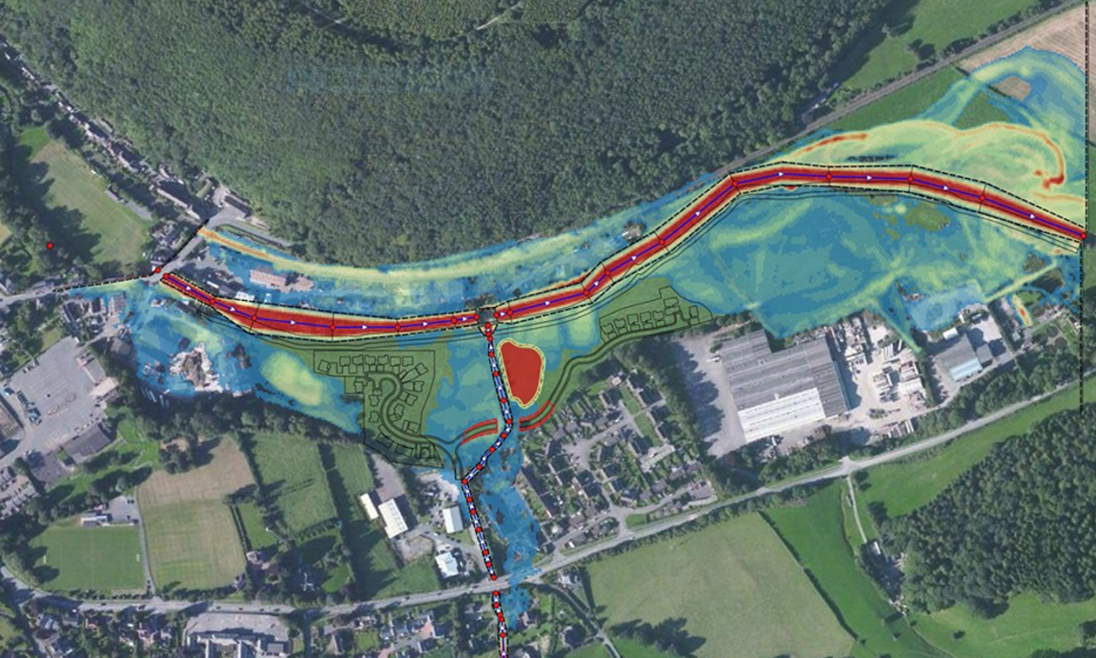
It is clear from the Risk of Flooding from Surface Water mapping that the methodology used in its development has significantly changed; what’s not so clear is how it has changed. The technical detail underpinning the updated flood modelling is fundamental to understanding the limitations and potential applications of the outputs, which guidance advises “are generally not suitable for property level assessment; instead they estimate flood risk to an area of land.”
Focusing on the positives, this latest iteration of mapping includes climate change outputs; this is a big step forward and will allow for a better assessment of the future risk of flooding in support of planning applications, local development plans and climate risk assessments. Currently, only a single climate change scenario is available, but it is expected that more are on the way:
“A near-term epoch (2040 – 2060 “2050s” epoch) and central allowances are being used initially, to support short and medium-term decisions informed by the highest flood likelihood projections.”
“More precise flood data enhances risk assessments for new developments and supports better planning and decision making. Greater detail means we can provide more detailed assessments in less time and at less cost. Improved understanding of flood risk will provide asset owners with the information needed to protect and maintain their portfolios and safeguard any critical infrastructure. This initial release is a promising first step and presents some great opportunities to deliver increased value for our clients; there is more to come, in the form of the updated Flood Map for Planning, surface water modelling methodology and further climate change scenarios.”
Brendan McCarthy, Flood Risk Partner

If you’d like to know more about the new National Flood Risk Assessment (NaFRA) and its application, or about our wider flood risk management service, please contact Brendan McCarthy at brendanmccarthy@ridge.co.uk

Thank you for signing up. We look forward to sharing updates with you